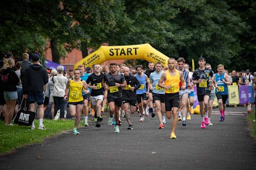

The Drop is an exhilarating navigation challenge designed for those who thrive on uncertainty. Unlike traditional races with clearly marked routes, The Drop plunges participants into unknown territory where every decision counts and self-reliance becomes paramount. Participants are dropped at a secret location 10 or 15 miles from the event center, armed only with their wits and determination to find their way back without any navigational aids. This stripped-back approach strips away all safety nets, leaving runners completely on their own as they navigate through unfamiliar terrain under a strict set of rules. For those up for an even more intense challenge, The Drop 6 offers a shorter but equally demanding option exclusively for non-locals. By removing the advantage that comes with local knowledge and familiarity, this version ensures that every participant faces the same level of uncertainty and unpredictability. Registration involves handing over all electronic devices and navigational aids in exchange for a race number and an emergency bag to be carried throughout the event. Upon arrival at their drop-off point—determined by blindfolded bus rides—the runners remove their blindfolds, start their timers, and begin navigating back towards the finish line. The challenge lies not just in covering ground but in making critical decisions under pressure without any external guidance or technology to rely on. The lack of maps, GPS devices, or compasses means that success hinges entirely upon individual navigation skills and mental fortitude. Live GPS tracking is available as an optional feature for those who wish to share their progress with friends and family from afar. This service provides real-time updates within a 5-meter accuracy range but requires participants to ensure the tracker has optimal placement for reliable performance throughout the event. The Drop promises an unforgettable experience that tests runners' abilities not just physically, but mentally as well. It's about staying calm when all certainty vanishes and relying solely on one’s instincts and skills to find the way home in a landscape devoid of familiar landmarks or guiding signs.
Races Offered
10 Miles
Nov 22, 2026
straighten
Distance —
16.1K
terrain
Type —
Others
timer
83 days remaining
sell
£45.00
15 Miles
Nov 22, 2026
straighten
Distance —
24.1K
terrain
Type —
Others
timer
83 days remaining
sell
£50.00
6 Miles
Nov 22, 2026
straighten
Distance —
9.7K
terrain
Type —
Others
timer
83 days remaining
sell
£35.00
Weather History
These values represent the 3-year monthly averages for November in Spital Tongues.
thermostatTemperature
4.2° / 9.5°
wb_sunnyFeels like
0.4° / 6.1°
light_mode
Avg sunshine hours
3h 58m
water_drop
Avg rainfall
2.9 mm
ac_unit
Avg snowfall
0.2 cm
air
Avg wind speed
13.4 km/h (Gentle breeze)
opacity
Sweat loss rate
Low
terrain
Course conditions
Firm and slightly soft
sunny
Max UV Index
Low (1.4)
humidity_mid
Humidity
85.8%
wb_twilight
Sunrise
08:38
nightlight
Sunset
17:03
About Spital Tongues
Learn more about the host city, Spital Tongues.
Spital Tongues is a district of Newcastle upon Tyne, located due north-west of the Newcastle City Centre. Its unusual name is believed to be derived from spital – a corruption of the word hospital, commonly found in British place names - and tongues, meaning outlying pieces of land. North of Spital Tongues is the Town Moor, while Castle Leazes and Leazes Park are to the East.